Selected work
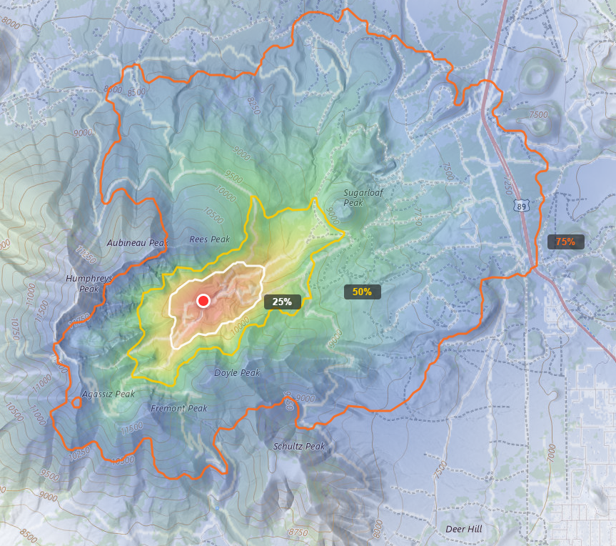
WiSAR Decision Support Tool
Created a web-based decision support tool for wilderness search and rescue that generates terrain-aware probability surfaces to rank search segment priority. The tool introduces Terrain-Aware Range Rings (TARRs), which replace traditional Euclidean range rings with cost-distance contours that reflect how terrain actually shapes travel, stretching along trails and valleys, compressing against steep slopes, and stopping at water barriers. Integrates CalTopo segment geometries with an anisotropic cost-distance model built from open data (USGS 3DEP, NLCD, OSM trails/roads/power lines, NHD hydrology), with two-way CalTopo export to push TARRs and POA rankings back to operational maps. Validated against 360 historical subjects from 253 Coconino County WiSAR missions, with calibration multipliers tuned per profile and per band that bring containment rates to within 2 percentage points of nominal at all three percentile thresholds. Runs live at sar.weleber.net, free, browser-based, no GIS software or licensing required.
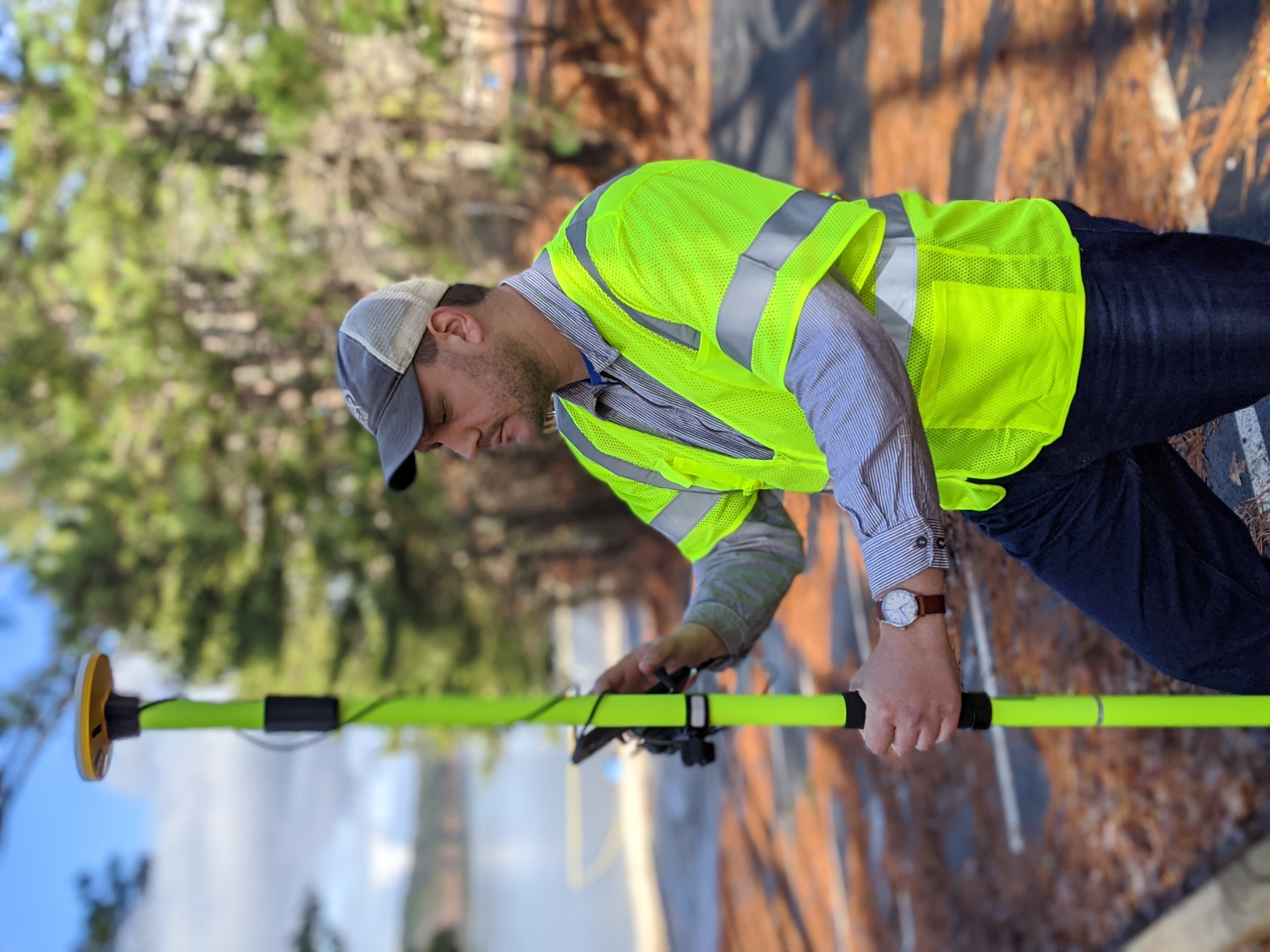
USACE GIS Collection & Verification
Designed, implemented, and managed a national-scale GIS data collection program for the U.S. Army Corps of Engineers, training and deploying crews across 43 states to inventory transportation and recreation assets at over 4,600 sites. Authored the field data collection manual, data processing guide, and operational plan that established standardized attribute schemas, collection protocols, and quality assurance procedures across all teams - ensuring consistent, reliable data from crews operating independently nationwide. Built systematic quality control workflows into the data processing pipeline to validate attribution accuracy and spatial integrity before delivery. The final dataset, delivered in an SDSFIE-compliant geodatabase satisfying both USACE and Department of Transportation requirements, enabled the agency's continued eligibility for Federal Lands Transportation Program (FLTP) funding.
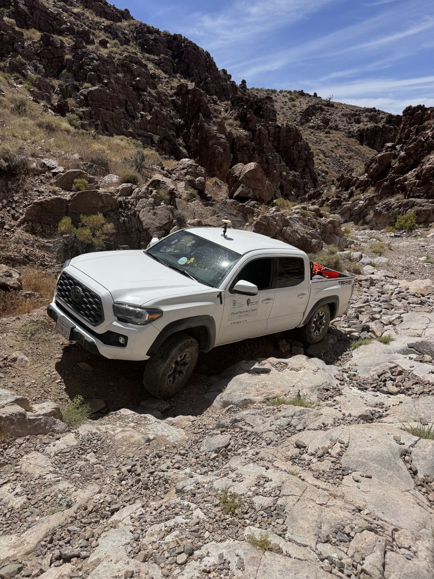
Death Valley Flood Recovery
Authored the GIS data collection protocol and damage classification schema for post-flood assessment of over 1,100 miles of unpaved roads in Death Valley National Park. Designed standardized attribute structures and domain-constrained field inputs to ensure consistent damage assessments across multiple field teams operating in one of the harshest environments in North America. Supported the park's emergency incident response with geospatial dashboards that provided both situational awareness and real-time quality control visibility into incoming data. The resulting dataset was immediately adopted by the Park to prioritize and allocate federal disaster funding for the most critical repairs to its transportation network.
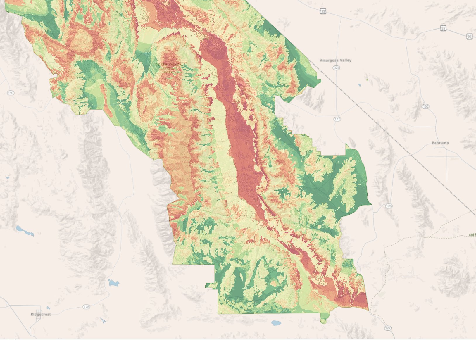
Desert Tortoise HSI Modeling
Created a multi-criteria habitat suitability model for the Mojave desert tortoise across Death Valley's 3.4 million acres, synthesizing 7 environmental variables into a continuous suitability surface. Extended the model into a NEPA compliance tool that automates habitat quality classification and generates standardized consultation language.
Derived core habitat boundaries from the continuous surface using focal density analysis scaled to desert tortoise home range sizes. Rather than mapping every qualifying pixel, this approach identifies areas of concentrated suitable habitat, producing ecologically meaningful management zones attributed with habitat category, acreage, and descriptive fields. The resulting polygon layer directly supports NEPA project review, conservation prioritization, and restoration planning across the park.
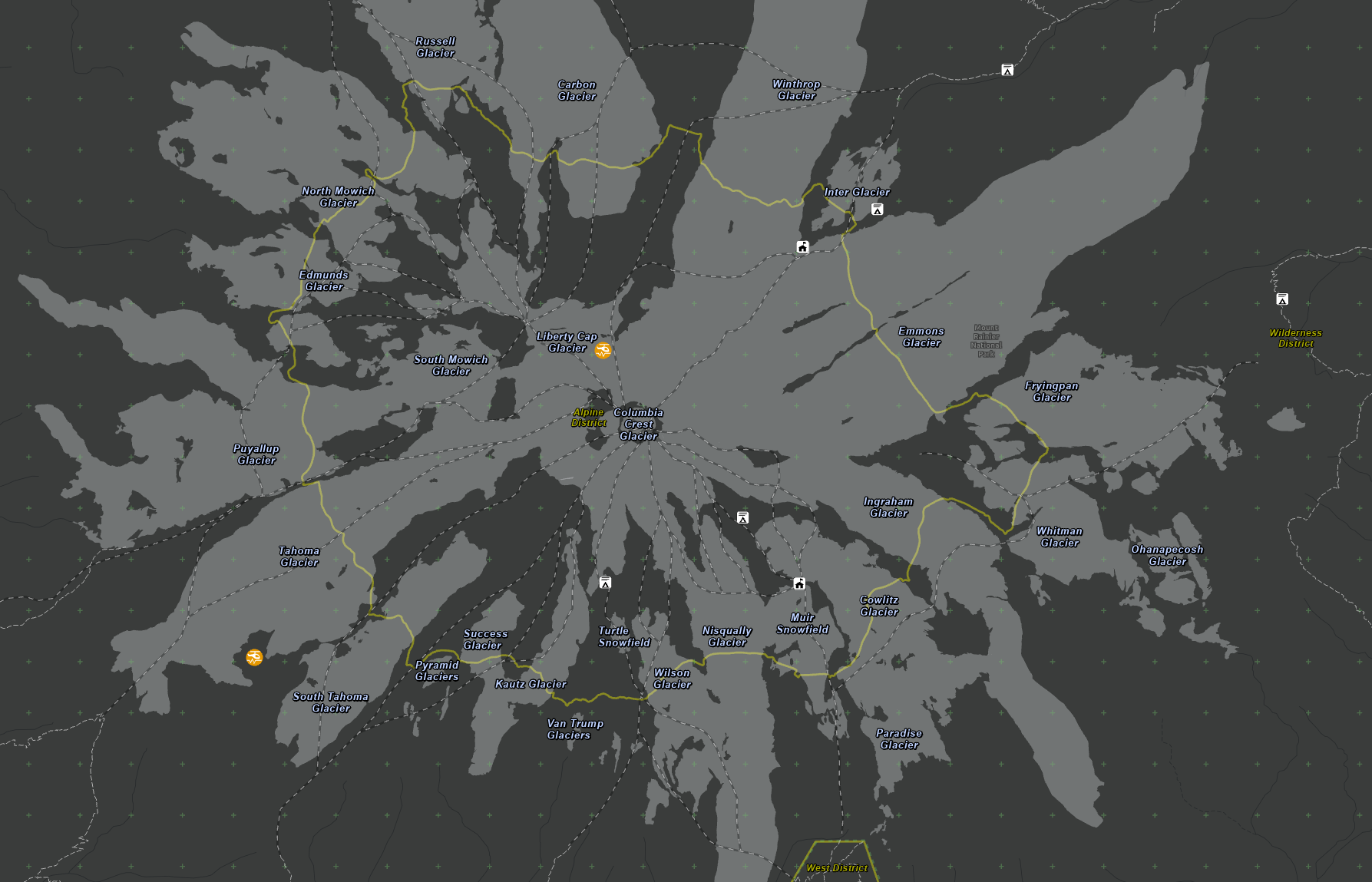
Mark43 CAD Reference Cartography
Developed a comprehensive GIS reference layer package for Mount Rainier's implementation of the Mark43 computer-aided dispatch system. Consolidated all operational spatial data into a 5-layer subtype architecture with scale-dependent symbology and labeling designed to provide detail at close zoom without clutter at broad scales, all optimized for Mark43's Dark Gray Canvas basemap.
Metadata Standards & Portal Publishing
Developed a repeatable metadata documentation program producing FGDC-compliant XML records and NPS-branded inline-CSS Portal HTML descriptions for every published geospatial dataset. Created a reusable template adopted by the park and flagged by the National Park Service's Washington Office for service-wide standardization.